
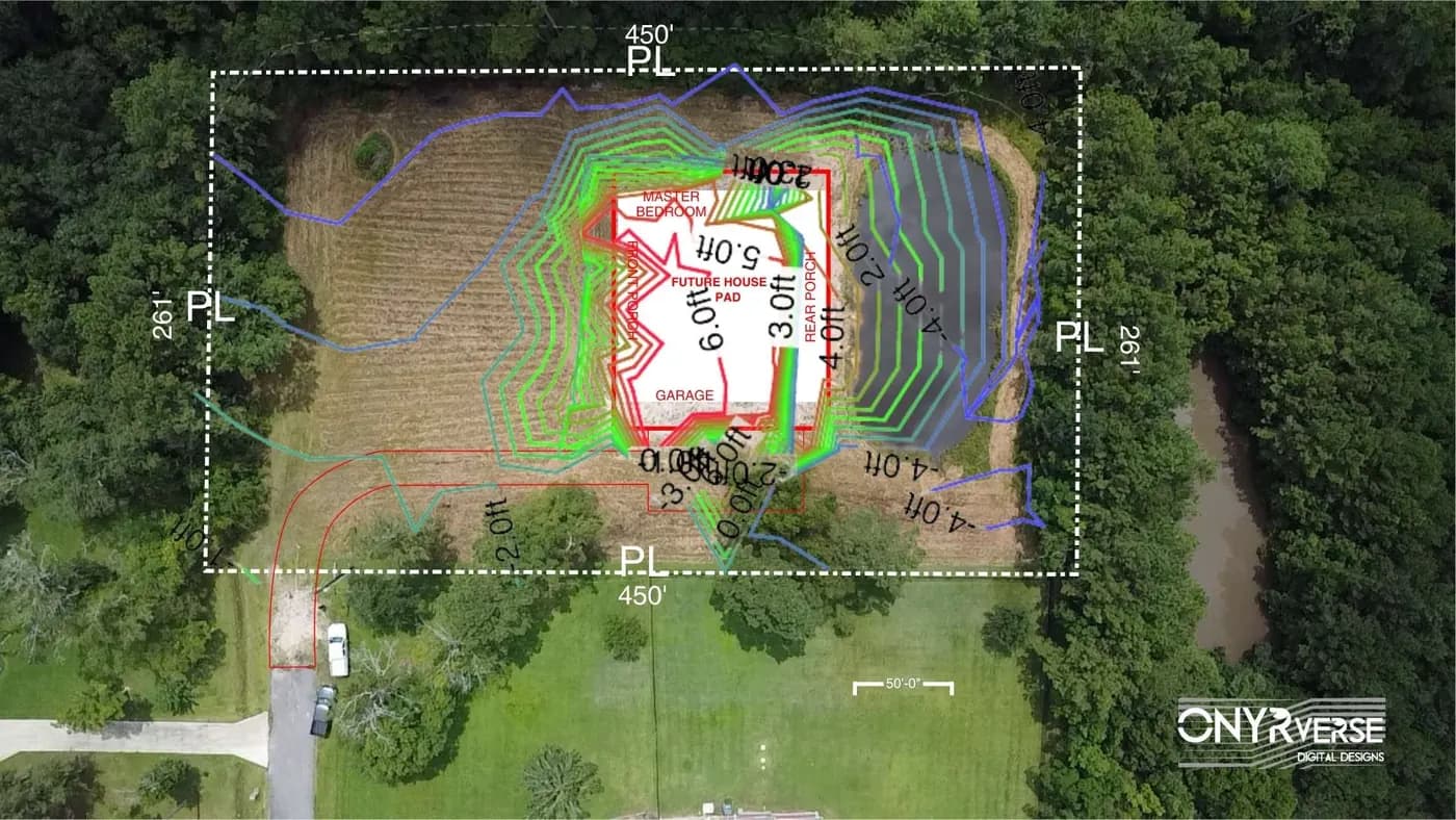
Site Plans + Grading + Utilities
Civil and Site Drafting for Southeast Texas Properties
If you're going to do it, do it with ONYR.
A building is only as good as the ground it sits on and the way water, vehicles, and utilities reach it. On the Gulf Coast, where land is flat, rain comes hard, and soils can move, the site plan often decides whether a project gets approved on the first submittal or bounces back with comments. ONYRverse prepares civil and site drafting that turns site decisions into clear, organized sheets that reviewers, lenders, and crews can follow.
Our drafting team prepares the drawings. Civil design decisions, calculations, and any required seal come from licensed Texas professional engineers on the project team, and boundary information comes from a registered surveyor. We coordinate between them, the architectural design, and the owner so the site sheets and the building sheets tell the same story.
Licensed engineering partners
ONYRverse prepares the drawings and coordination. The engineering is reviewed and stamped by licensed partner firms:
- Civil
- Aaron & Franklin, Fitz & Shipman
What Belongs in a Civil Drawing Set
Civil drawings describe everything outside the building footprint and below finished grade. For a small residential lot, that may be a single site plan showing the house, drive, setbacks, and utility connections. For a commercial or multifamily project, it grows into a series of sheets covering layout, grading, drainage, utilities, paving, and details.
We scale the set to the project and the jurisdiction. The goal is not more sheets. The goal is that anyone who opens the set, from a plan reviewer to a dirt contractor, can find what they need without guessing.
- Dimensioned site and layout plans with setbacks and easements
- Grading plans with existing and proposed elevations
- Drainage plans showing flow direction, swales, culverts, and inlets
- Utility plans for water, sewer or septic, storm, and service routing
- Paving, parking, and driveway layouts with striping
- Erosion control plan drafting and standard site details
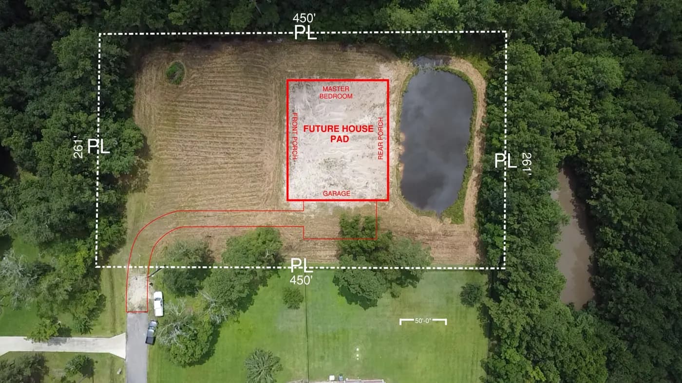
Grading and Drainage on Flat Coastal Ground
Much of Southeast Texas sits close to sea level with very little natural slope, so water does not always go where people assume. A pad set a little too low, a driveway culvert sized by habit, or a neighbor's fill can turn a new building into a drainage problem. Grading and drainage sheets make the intended water path visible before any dirt moves.
The civil engineer sets the design: finished floor elevations, pad heights, detention needs, and pipe or culvert sizing. We draft those decisions into spot elevations, contours, flow arrows, and details that site preparation contractors can build from, and we flag conflicts with the architectural plans, such as a door threshold that no longer matches the proposed grade.
Utilities, Access, and Parking Layouts
Utility routing is one of the quiet sources of change orders. Water, sewer, storm, power, and gas all need a path to the building, and on commercial sites they compete for the same corridors as parking, landscaping, and drives. Showing those paths on one coordinated sheet catches crossings and clearance issues early.
Access and parking layouts show drive widths, turning areas, parking counts, and accessible spaces and routes. Where a drive connects to a state highway, a TxDOT access permit is typically part of the process, and city streets have their own driveway rules. We draft to the requirements identified by the project engineer and the reviewing authority, so the layout reflects what will actually be approved.
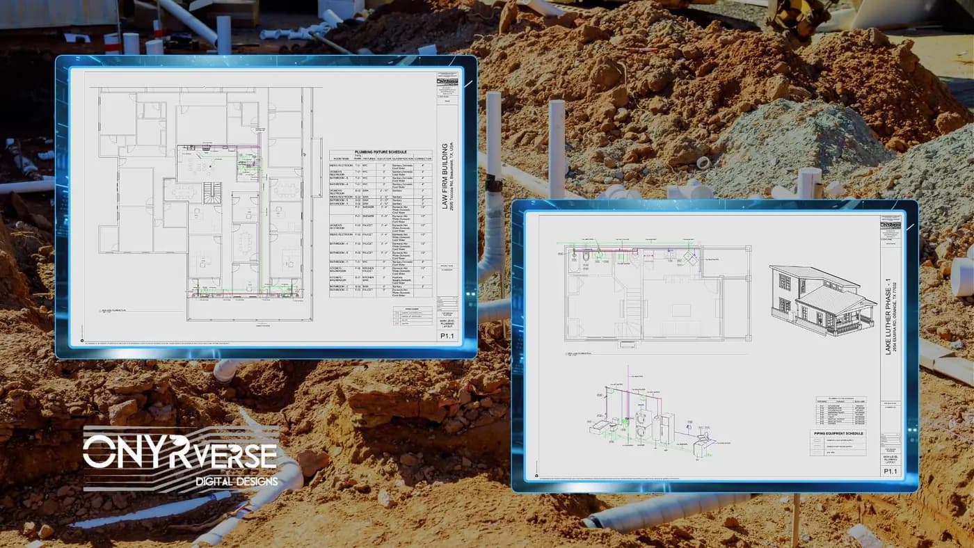
Starting From Real Site Data
Civil drafting is only as accurate as the base information under it. We build site sheets from the boundary and topographic survey prepared by a registered professional land surveyor, and supplement it with our own drone capture, lidar scanning, and Moasure elevation assessments for visual context and early planning.
Soil conditions matter here too. A geotechnical report from a licensed geotechnical engineer informs pad preparation and foundation recommendations, which in turn affect grading. We carry those recommendations into the drawings as directed by the engineers, so the site work and the foundation design line up.
Who Draws It, Who Designs It, Who Seals It
Clear roles protect owners. ONYRverse is a design and documentation studio. We prepare civil and site drafting, coordinate the team, and keep the drawing set consistent. We are not a civil engineering firm, and we do not design drainage systems, calculate detention, or seal civil documents.
When a project requires civil design or a sealed site plan, that work comes from a licensed Texas professional engineer (PE), and boundary work comes from a registered professional land surveyor. We draft to their direction and incorporate their markups, giving you one coordinated set instead of disconnected documents from different offices.
How Civil Drafting Works at ONYRverse
- 01
Collect Site Information
We gather the survey, plat, geotechnical report, utility information, and any existing drawings, and add drone, lidar, or Moasure capture when more context is needed.
- 02
Confirm Requirements and Team
We identify the reviewing authority, confirm which licensed engineer and surveyor are on the project, and agree on the sheets the jurisdiction will expect.
- 03
Draft the Site Set
We prepare layout, grading, drainage, utility, and paving sheets from the engineer's direction and coordinate them with the architectural and building plans.
- 04
Engineer Review and Revisions
The civil engineer reviews and marks up the drawings. We incorporate the changes and check that site elevations and building sheets still agree.
- 05
Submittal and Field Support
We package the final sheets for permit submittal and respond to review comments with the engineer, then support site preparation contractors with clarifications.
Civil Drafting FAQs
Do I need civil drawings for a single house or barndominium?
Often you need at least a site plan showing the building, setbacks, drive, and utilities, and some jurisdictions or lenders also want grading or drainage information, especially in flood-prone areas. Requirements vary by city and county. We confirm what your permitting authority expects for your address and scale the drawings to match, so you are not paying for sheets nobody asked for.
Can ONYRverse seal a site plan or drainage plan?
No. ONYRverse prepares civil and site drafting, but we do not seal drawings or design drainage systems. When a sealed plan is required, a licensed Texas professional engineer designs and seals it. We draft to that engineer's direction and coordinate the site sheets with the architectural set, so you receive one consistent package ready for review.
Why does grading matter so much in Southeast Texas?
The region is flat and low, heavy rain is common, and small elevation differences decide where water goes. A building pad set too low or a drive that blocks natural flow can cause standing water, flooding, or problems with neighbors. Grading and drainage sheets make the intended water path clear before construction, when correcting it is still inexpensive.
Can site preparation contractors work from your drawings?
Yes, that is part of the purpose. Clear layout, grading, and drainage sheets give site preparation contractors the pad locations, elevations, culvert positions, and drive layouts they need for clearing, fill, and pad building. Once the engineer has approved the design, our drawings help those crews build it as intended and reduce guesswork in the field.
Is a drone map good enough to use instead of a survey for civil drafting?
No. Drone, lidar, and Moasure data are excellent for context and early planning, but civil drawings for permitting and construction should be based on a boundary and topographic survey from a registered professional land surveyor. We use our capture data to supplement the survey and to help everyone visualize the site, not to replace it.
Civil Drafting Across Southeast Texas
- Beaumont, TX
- Port Arthur, TX
- Nederland, TX
- Groves, TX
- Port Neches, TX
- Orange, TX
- Vidor, TX
- Bridge City, TX
- Lumberton, TX
- Silsbee, TX
- Sour Lake, TX
- Winnie, TX
- Mauriceville, TX
- Kountze, TX
- Bevil Oaks, TX
- Fannett, TX
- China, TX
- Evadale, TX
- Nome, TX
- Pinehurst, TX
- West Orange, TX
- Buna, TX
- Deweyville, TX
- Ames, TX
- Hardin, TX
- Anahuac, TX
- Liberty, TX
- Kirbyville, TX
- Dayton, TX
- Woodville, TX
- Newton, TX
- Jasper, TX
- Rose City, TX
- Pine Forest, TX
- Central Gardens, TX
- Pinewood Estates, TX
- Taylor Landing, TX
- Hamshire, TX
- Little Cypress, TX
- Forest Heights, TX
- Stowell, TX
- Devers, TX
- Daisetta, TX
- Hull, TX
- Wildwood, TX
- Warren, TX
- Kenefick, TX
- Oak Island, TX
- Old River-Winfree, TX
- Ivanhoe, TX
- Cove, TX
- Mont Belvieu, TX
- Big Thicket Lake Estates, TX
- Bolivar Peninsula, TX
- Beach City, TX
- Starks, LA
- Vinton, LA
- Hackberry, LA
- Carlyss, LA
- Sulphur, LA
- DeQuincy, LA
Related services
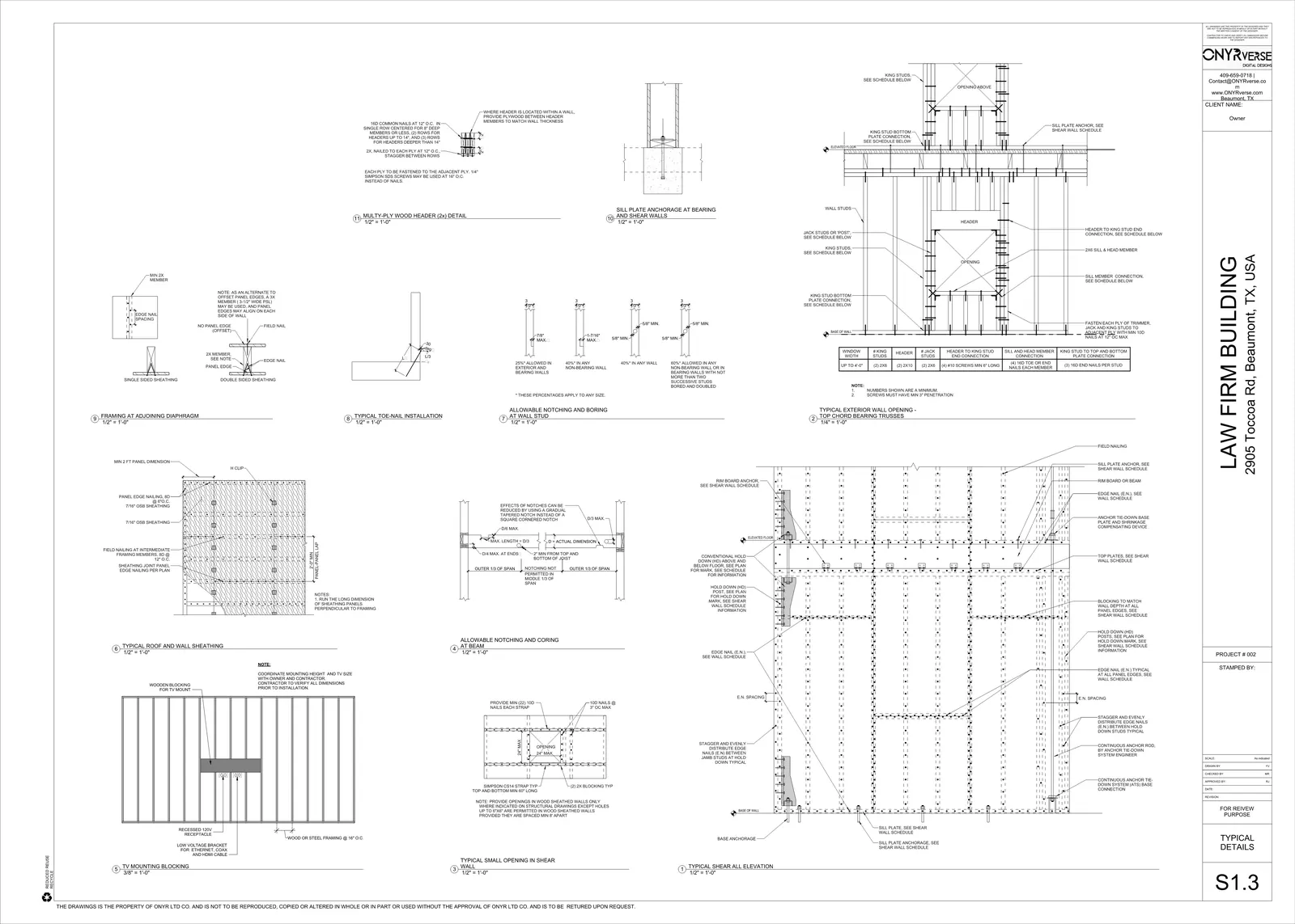
Drafting & CDs
Architectural and civil drafting services in Beaumont, TX, including permit sets, construction documents, site plans, and as-built drawings built for permitting, bidding, and construction.
Learn more →
Feasibility Planning
Feasibility and design planning in Beaumont, TX: site discovery, code and jurisdiction research, and a budget-guided concept that shows whether a project works before you pay for full design.
Learn more →Drone Mapping
ONYRverse captures drone aerial imagery and site data for planning, design, and construction progress monitoring, and ties it directly into your project documentation.
Learn more →
Get Your Site Plans Drafted Right the First Time
Send us your survey, plat, or concept and tell us what you plan to build. We will scope the civil and site drafting your project needs and coordinate it with your licensed engineer and surveyor.
Ready to move your project forward?
Tell us about your project in the Design Brief intake form, or call to talk it through. If you're going to do it, do it with ONYR.