

Chambers County, Texas
Raised Bay House and Camp Plans for Oak Island, Texas
If you're going to do it, do it with ONYR.
Oak Island is a small bayside community of a few hundred residents on the eastern shore of Trinity Bay, tucked between the east and west forks of Double Bayou about eight miles south of Anahuac. It began in 1951 when developers laid out lots on the site of an old fishing camp, and the name comes from a stand of oaks near the bayou mouth. What gets built here is personal and practical: a full-time house for a family that fishes and works nearby, a weekend camp with a boat lift, a replacement for a house the last storm took, or a shop to keep gear out of the salt air.
Hurricane Ike in 2008 left most Oak Island homes unlivable, and the community rebuilt one lot at a time. That history shapes every project we see from here. ONYRverse Digital Designs is a Beaumont studio roughly 44 miles away. We do the design and documentation work from our studio, share models and drawing sets online, and schedule trips down to Oak Island for measurements, photographs, and drone capture of the lot and the bayou edge. We do not have an office on the bay and will not pretend otherwise.
Between the Forks of Double Bayou: Reading the Lot First
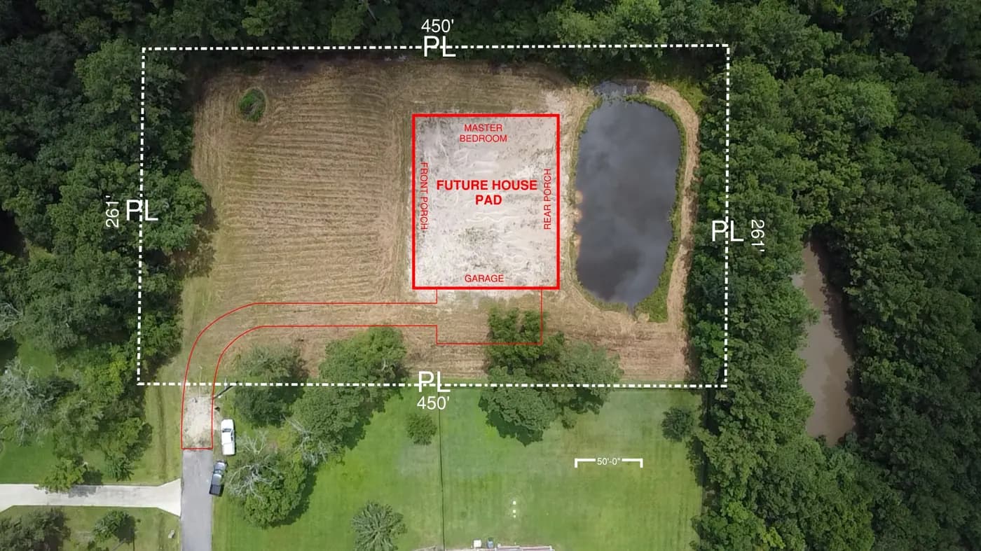
On a bayou-front lot the first drawing we need is not a floor plan. It is an honest picture of the ground: how high the lot sits, where the FEMA flood map places it, where water pooled after the last big rain, where the septic system and drain field can go, and how a truck and trailer get in and out. Chambers County asks for an elevation certificate on projects in a flood zone, so we plan the finished floor height early and design around it instead of discovering it at review.
Drone capture helps a lot here. A single scheduled flight gives us an aerial map of the lot, the neighboring structures, the shoreline, and the access road, which we use to place the house, the boat lift, and any accessory building before anyone commits to a foundation. When soil or elevation questions go beyond what the drawings can answer, we bring in a licensed surveyor or geotechnical engineer rather than guessing.
Rebuilding the Post-Ike Generation of Houses
Much of Oak Island was rebuilt after 2008, and many of those houses are now old enough for their owners to want more: an enclosed porch, a bigger kitchen, a second bedroom over the parking level, or a full replacement of a house that was patched rather than rebuilt. Each of those projects touches the load path and, often, the flood elevation. Our first step is a measured as-built of what is there, followed by a clear set of options with the tradeoffs spelled out.
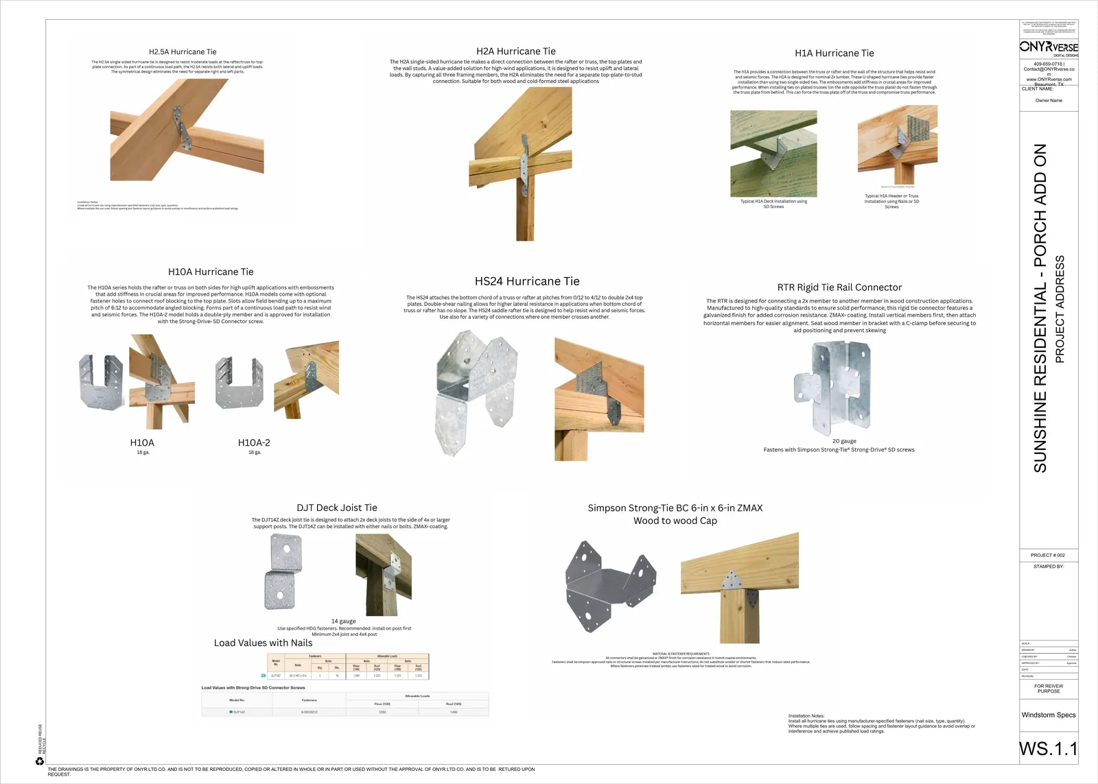
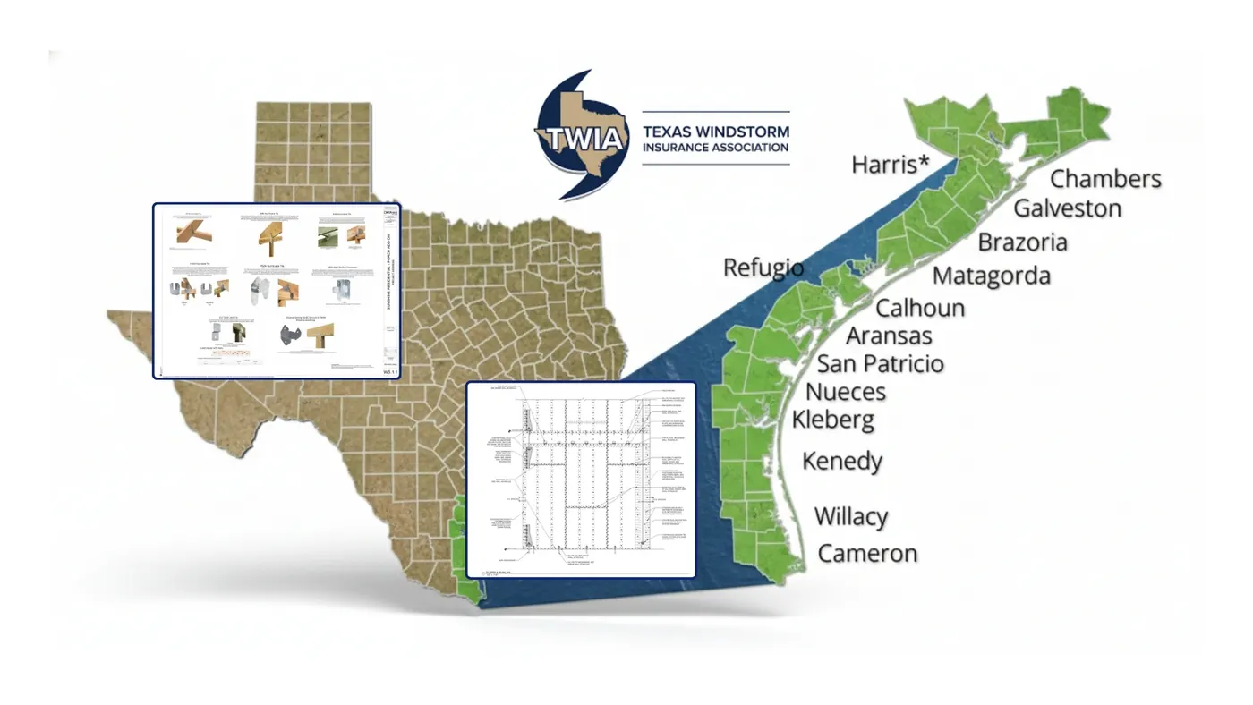
Because Chambers County is in the catastrophe area, the wind side of a remodel or new build matters for insurance as much as for safety. We prepare windstorm-ready documentation: roof-to-foundation connection details, sheathing and fastening notes, opening protection, and connector schedules keyed to the design wind speed set by the adopted code for the site. WPI-8 certification comes through a TDI-appointed qualified inspector or a licensed Texas professional engineer who inspects during construction. We coordinate with that professional; we never issue the certificate.
No Town Hall on the Bayou: The Permit Trip Runs Through Anahuac
Oak Island has no city government, so your plans are reviewed by Chambers County. The county reviews residential work for drainage, fire code, and environmental health, and commercial projects can request a Development Review Committee meeting to talk through a plan with every county reviewer before submitting. We prepare the site plan, floor plans, elevations, and wind details in the format the county portal expects, and we respond to review comments until the permit issues.
Typical Oak Island scopes we are set up to document include:
- Raised homes on piers with parking and storage below
- Weekend camps and fishing cabins with decks facing the bayou
- Additions and enclosed porches on post-2008 houses
- Detached shops and boat storage buildings
- Replacement homes where an older structure is past saving
Services for Oak Island Projects
Windstorm Design in Oak Island, TX
Windstorm-ready design documentation in Beaumont, TX, with a continuous load path, connector details, and coordination with a licensed engineer for TDI WPI-8 certification.
Learn more →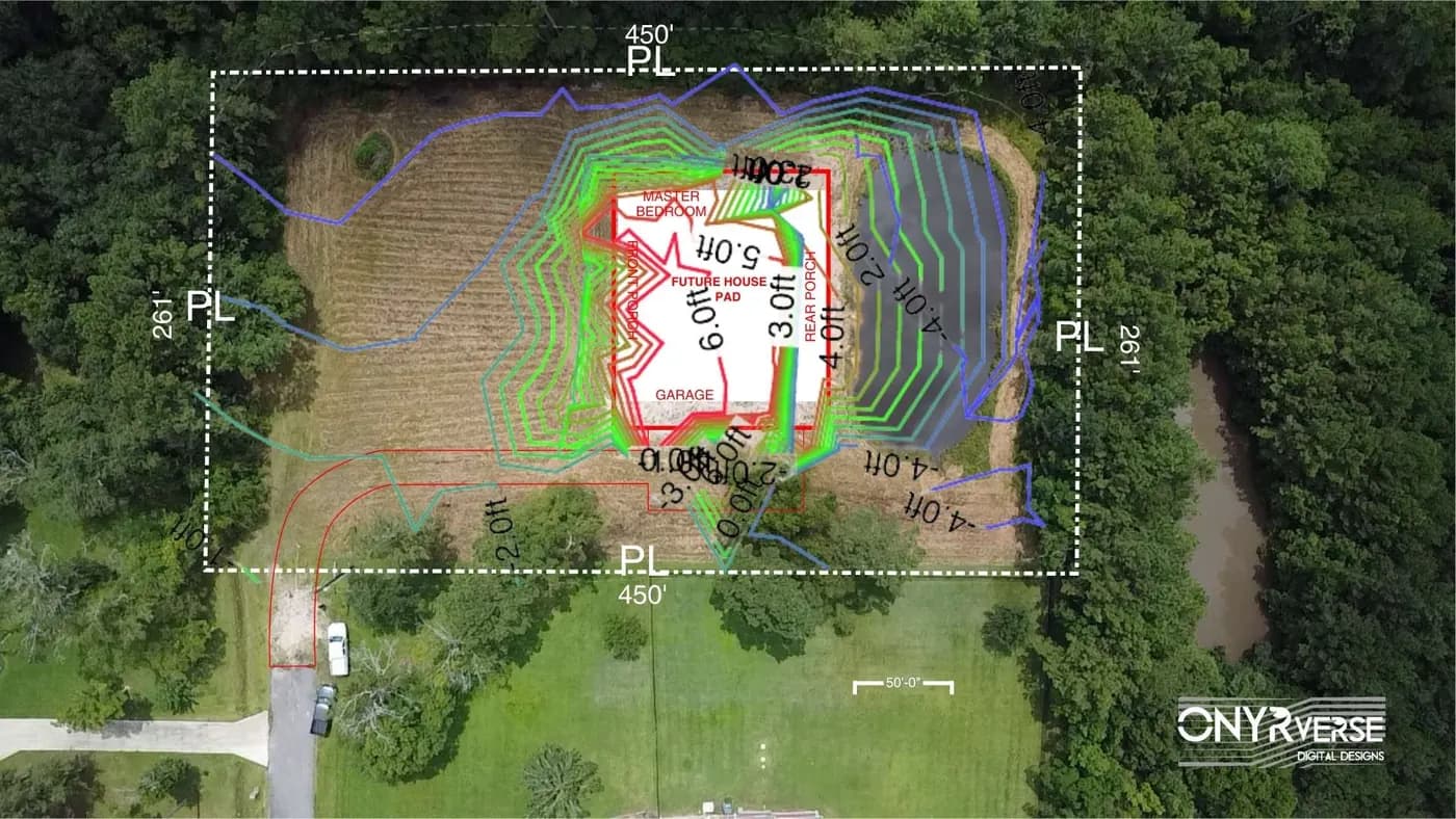
Drone Mapping in Oak Island, TX
ONYRverse captures drone aerial imagery and site data for planning, design, and construction progress monitoring, and ties it directly into your project documentation.
Learn more →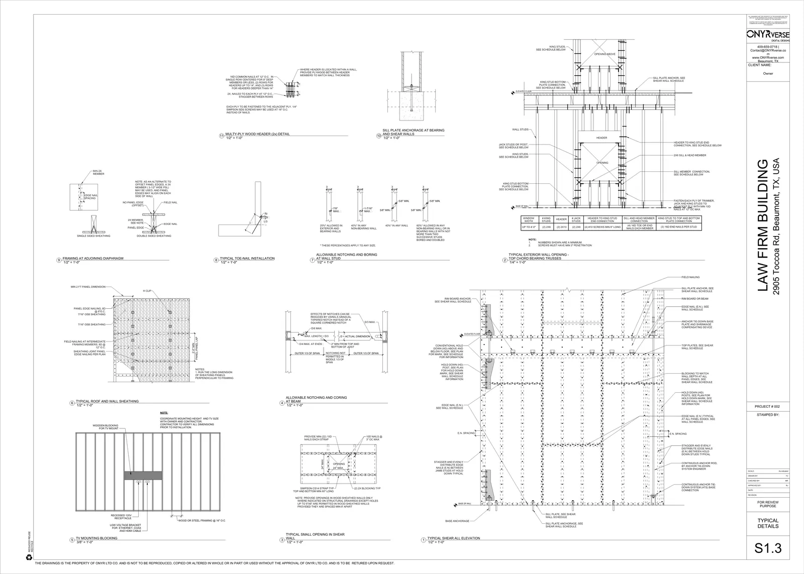
Drafting & CDs in Oak Island, TX
Architectural and civil drafting services in Beaumont, TX, including permit sets, construction documents, site plans, and as-built drawings built for permitting, bidding, and construction.
Learn more →
Structural Coordination in Oak Island, TX
ONYRverse coordinates your licensed Texas structural engineer with your architectural plans so structure and design intent stay aligned from concept to permit.
Learn more →
Oak Island Project FAQs
Oak Island is not a city. Who approves my building plans?
Chambers County does. Because Oak Island is an unincorporated census-designated place, there is no city building department. Plans are submitted to the Chambers County Permit Office in Anahuac through its online portal and reviewed for drainage, fire code, and environmental health. ONYRverse prepares the drawings in the format the county expects and handles review comments with you.
My Oak Island house was rebuilt after Ike. Can I add a room without starting over?
Usually, yes. We begin by measuring the existing house and documenting how it is framed and elevated. From there we show you where an addition fits the flood elevation and the existing load path. If framing or foundation changes are needed, a licensed structural engineer designs them and we fold their work into the permit set.
Do I need an elevation certificate to build a camp near Double Bayou?
If the lot is in a mapped flood zone, Chambers County may require an elevation certificate as part of the permit review. A licensed surveyor prepares it. We use the flood map and the surveyor's data to set the finished floor height, then design the stairs, parking level, and storage below around that elevation.
Can you fly a drone over my lot before we start designing?
Yes. Drone capture is one of the first things we schedule for bayside lots. The aerial map shows the lot lines in context, the shoreline, neighboring structures, trees, and access. It gives us an accurate base for placing the house, a boat lift, and any shop building, and it saves guesswork on a site you may only visit on weekends.
Will my windstorm plans be enough for TWIA coverage on Oak Island?
The plans are one part. TWIA eligibility in the catastrophe area generally depends on a WPI-8 certificate, which follows inspections by a TDI-appointed qualified inspector or licensed engineer during construction. ONYRverse prepares windstorm-ready drawings and coordinates with that professional so the details on paper match what the inspector expects to see in the framing.
Nearby service areas
Planning a project in Oak Island?
Send us the basics and we will come back with next steps. Surveys, sketches and photos of the site all help.
Ready to move your project forward?
Tell us about your project in the Design Brief intake form, or call to talk it through. If you're going to do it, do it with ONYR.