

Jefferson County, Texas
Windstorm-Ready Building Plans for Port Arthur, Texas
If you're going to do it, do it with ONYR.
Port Arthur sits at the edge of Sabine Lake, wrapped by the Sabine-Neches Waterway and bordered by marsh on the south side. Few towns in Texas feel the Gulf as directly. Hurricanes Rita in 2005 and Ike in 2008 left their mark here, and Hurricane Harvey's rainfall in 2017 flooded neighborhoods across the city. When someone in Port Arthur asks us to design a home, a church hall, or a commercial building, wind and water are part of the first conversation, not an afterthought.
ONYRverse is a Beaumont design and documentation studio about 20 miles up the highway. We help Port Arthur property owners, pastors, small business owners, and industrial contractors turn a concept into plans that are fundable, approvable, and buildable. Our role is to manage the portal: collect input from the builder, the lender, the insurer, and the licensed engineers, resolve it on paper, and hand the reviewer a set that tells one clear story.
Designing for Sabine Lake Weather
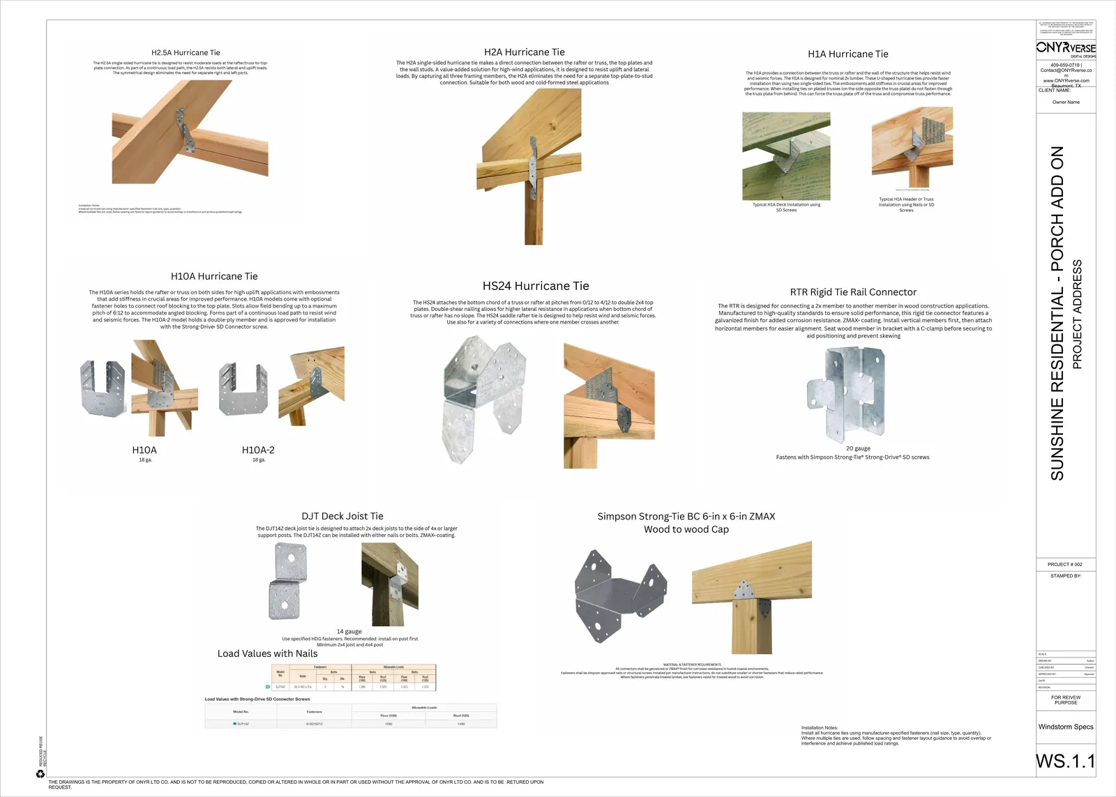
Wind design on the coast starts with the load path: roof sheathing to rafters or trusses, trusses to walls, walls to foundation. Every link has to be shown, specified, and inspectable. ONYRverse drafts connector schedules, strapping and anchoring details, opening protection notes, and wall bracing callouts so that the builder knows exactly what to install and the inspector knows exactly what to look for.
The design wind speed and exposure category for a given Port Arthur lot are set by the adopted code for the site, and our documents reference them directly. For WPI-8 certification, we coordinate with a TDI-appointed qualified inspector or licensed Texas professional engineer. ONYRverse does not issue WPI-8 certificates; we make sure the plan set supports the people who do.
Because the drawings, the connectors, and the inspections all have to agree, some Port Arthur owners prefer to keep design and construction with one team. When ONYRverse builds, the details drafted here are the same ones our Site Construction Manager checks on site before the inspector arrives, and the finished work carries a 1-year craftsmanship warranty.
Flood Maps, Elevation, and the Lot You Actually Have
Large parts of Port Arthur sit behind the hurricane protection levee system, yet many parcels still carry FEMA flood zone designations. Before we lay out a floor plan, we check the effective flood map and any base flood elevation, then design stairs, ramps, parking, and utility placement around the required finished floor height. It is far easier to plan an elevated home or raised slab from day one than to redesign after a floodplain comment.
Support for Industrial and Commercial Owners
Port Arthur's economy runs on refining, shipping, and the contractors who serve them. Those clients need project management on the design side: defined scope, controlled decision points, and documentation that satisfies owners, public agencies, and lenders. We manage design schedules and stakeholder alignment and can add drone aerial mapping to capture a site, a laydown yard, or progress on a building pad. Owners who want one contract from drawings to finished building can have ONYRverse hold the build contract, with Site Construction Manager Evan Simon as their contact on site; others take the finished set to a builder of their choice. Either way, we coordinate licensed engineers whenever the work requires a stamp.
- Office and shop buildings for service contractors
- Church fellowship halls and community centers
- Storm-damaged home rebuilds and elevated replacements
- Retail and restaurant buildouts along major corridors
Services for Port Arthur Projects
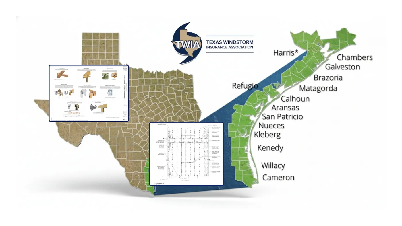
Windstorm Design in Port Arthur, TX
Windstorm-ready design documentation in Beaumont, TX, with a continuous load path, connector details, and coordination with a licensed engineer for TDI WPI-8 certification.
Learn more →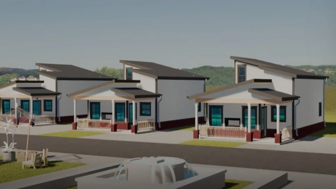
Architectural Design in Port Arthur, TX
Architectural design services in Beaumont, TX that turn residential, commercial, barndominium, tiny home, and renovation concepts into buildable plans, design only or design and build.
Learn more →Project Management in Port Arthur, TX
ONYRverse manages industrial, commercial, and municipal projects from the first design decision to the finished build, with design-only or design-build delivery.
Learn more →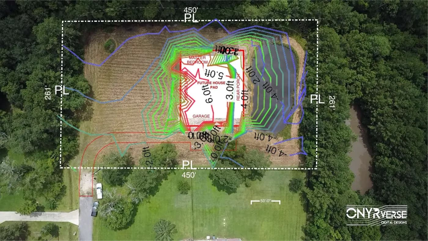
Drone Mapping in Port Arthur, TX
ONYRverse captures drone aerial imagery and site data for planning, design, and construction progress monitoring, and ties it directly into your project documentation.
Learn more →
Port Arthur Project FAQs
My Port Arthur home was damaged in a storm. Can you draw the rebuild?
Yes. We document what remains, design the rebuild or replacement, and prepare windstorm-ready drawings with connector and anchoring details. If you want TWIA coverage, we coordinate with a TDI-appointed qualified inspector or licensed engineer for WPI-8 certification. We also check flood maps so the rebuilt home meets any elevation requirement that now applies to your lot.
Do you work on Pleasure Island or near Sabine Lake?
Yes. Waterfront parcels near Sabine Lake and on Pleasure Island face strong wind exposure and flood zone rules, so the design has to account for both from the start. We look at elevation, exposure, and access, then prepare plans for the City of Port Arthur review process. Any structural requirements are coordinated with a licensed Texas professional engineer.
Can you help a refinery contractor plan a new office or shop?
Yes. We handle architectural design, construction documents, and design-side project management for contractor offices, shops, and support buildings. We keep scope, assumptions, and exclusions written down so the owner, lender, and builder see the same project. If you want us to build it as well, the build price comes after the plans are done, and we bring in licensed MEP and structural engineers when the work calls for them.
Are your Port Arthur plans stamped by an engineer?
ONYRverse is a design and documentation studio, not an engineering firm, so we do not stamp or seal plans. When a project in Port Arthur needs stamped structural, windstorm, or MEP drawings, we coordinate with licensed Texas professional engineers and integrate their work into the full set, so the architectural and engineered sheets agree.
Can drone mapping help with a large Port Arthur commercial lot?
Yes. For larger commercial and industrial parcels, drone aerial mapping gives the design team an up-to-date view of the site, existing structures, drainage patterns, and access points. We use that imagery to inform layout and to document progress once construction starts. It does not replace a licensed survey when one is required, but it reduces surprises during planning.
Nearby service areas
Planning a project in Port Arthur?
Send us the basics and we will come back with next steps. Surveys, sketches and photos of the site all help.
Ready to move your project forward?
Tell us about your project in the Design Brief intake form, or call to talk it through. If you're going to do it, do it with ONYR.