
Drone Data Procurement, Aerial Mapping & Construction Progress Monitoring
If you’re going to do it,do it with ONYR.
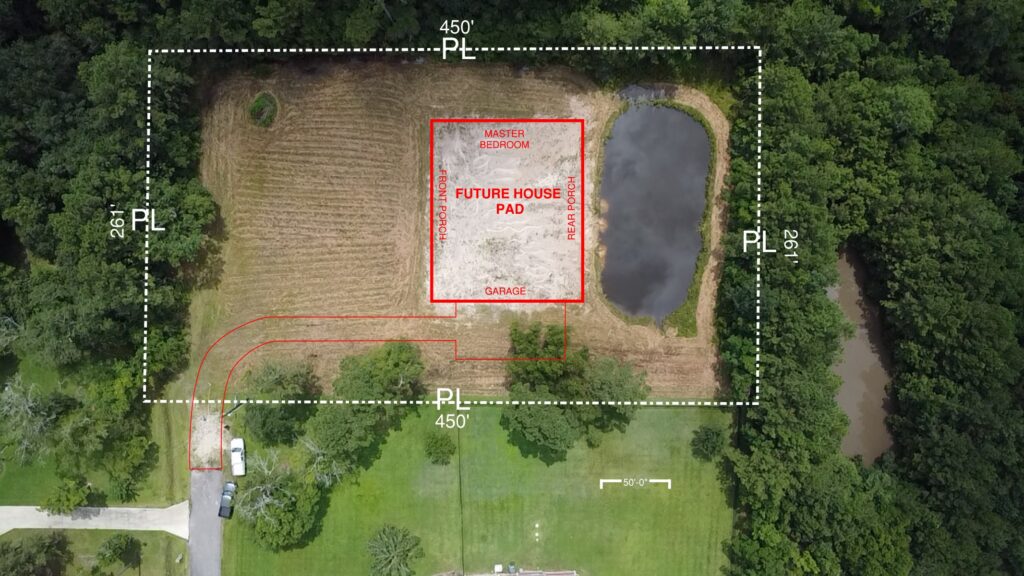
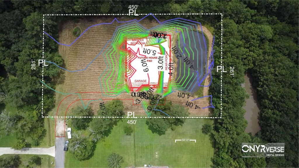
ONYRverse located in Beaumont, Texas, provides professional Drone Data Procurement services for construction projects, integrating drone technology into every phase of local design and project management. Our aerial mapping, construction progress monitoring, and precise as-built documentation deliver real-time, site-specific data that helps contractors, engineers, and developers make informed decisions, minimize delays, and keep projects on schedule.
Aerial Mapping & UAV Data Acquisition
- Aerial mapping for site analysis and planning
- UAV data acquisition and aerial data collection
- Pre-design site surveys to inform design and scope
Construction Progress Monitoring & As-Built Documentation
- Construction progress monitoring with visual timelines and updates
- As-built documentation for compliance and records
- Site analysis for ongoing project management
Our process ensures every data set is a portal for alignment—so your team, contractors, and stakeholders always have the latest site intelligenc
Why ONYRverse?
- We align drone data with project goals and documentation
- Our process supports faster approvals and fewer surprises
- We integrate aerial mapping into your overall project management workflow
Ready for better site intelligence? Contact us for aerial mapping or construction progress monitoring.
Beaumont, TX Based — Serving Southeast Texas and Beyond
ONYRverse is located in Beaumont, Texas. If you want a design partner who keeps stakeholders aligned and documentation clean, we’re ready.